Amid the lunch rush in the midday winter sun, I pace around a column fragment with my phone in hand. Ducking and weaving, I capture hundreds of photos from every conceivable angle. Around me, others mirror my movements: phones raised, framing scenes [of people] posing on the steps of Piazza San Donato or down a garden alley offering views over the Calanchi Valley hundreds of feet below. Each photo becomes a memento, shared online or kept private—a digital footprint of our time in Civita di Bagnoregio.
Unlike those passing tourists’ photos, my images won’t remain static. Instead, they'll be stitched together and processed to reconstruct the Roman column, bathed in warm Mediterranean light, within a three-dimensional environment—a digital twin accessible to anyone with an internet connection. This digital scanning process converts physical matter into its virtual counterpart, turning stone into pixels to ensure preservation, fidelity, and continued access, albeit within a virtual space.
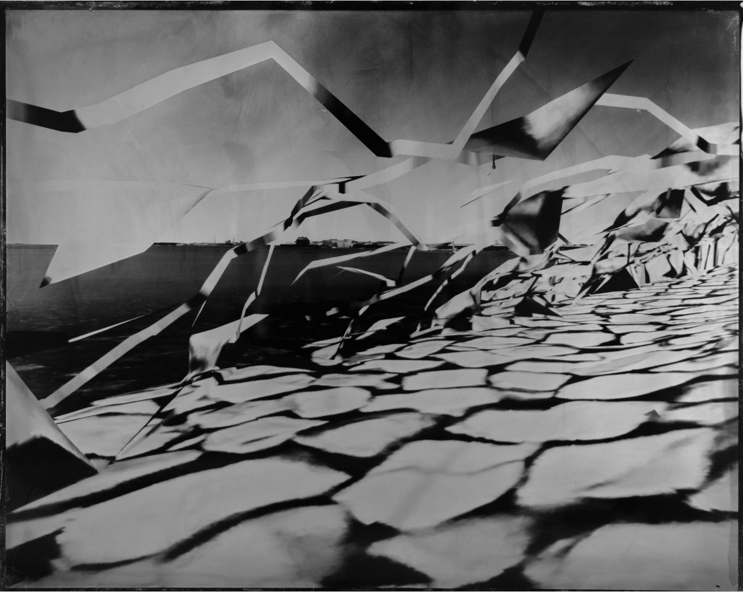
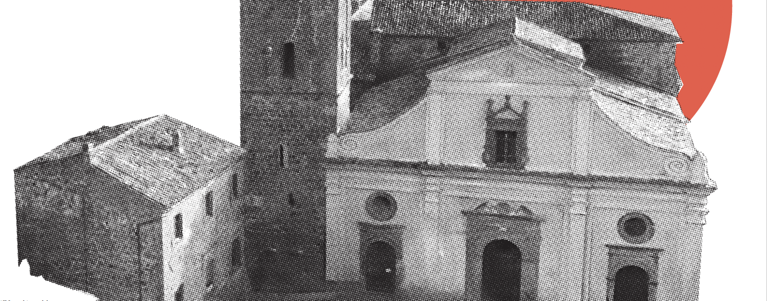
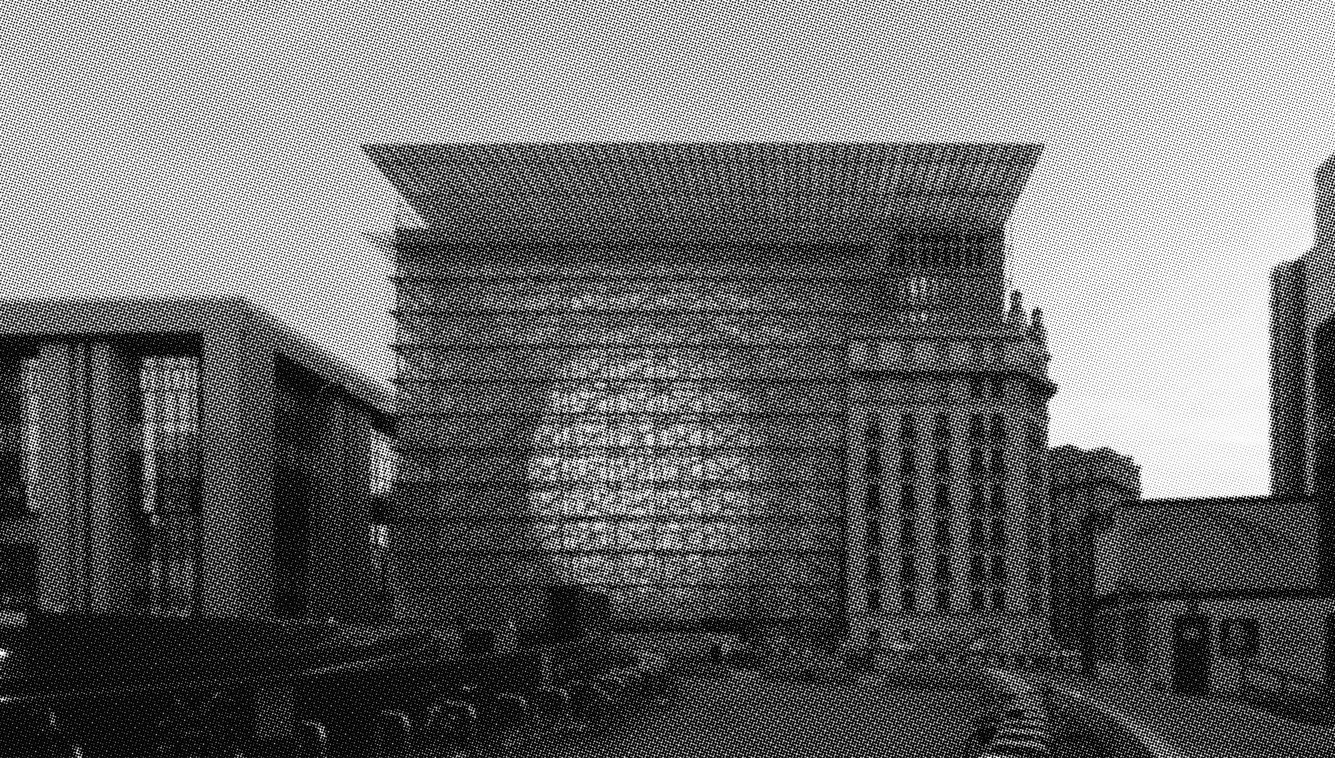
As the Civita Institute’s 2024 Cultural Landscape Fellow, I spent one month meticulously capturing the Italian hilltop town of Civita di Bagnoregio through drone photography, handheld camera imagery, and terrestrial LiDAR (Light Detection and Ranging) scans to create a comprehensive digital record of this fragile heritage site. Civita is a fairytale-like town, shaped by two-and-a-half millennia of human occupation, sitting atop a tuff mesa at constant risk of erosion, landslides, and seismic activity. It is a place where time is palpable, where the weight of history presses against the fragility of the present.
Producing digital twins—a form of what might be called cyber-archaeology—involves collecting and preserving archaeological data in digital form, enabling access, visualization, and analysis through a workflow defined by four key steps: digital capture, curation, analysis, and dissemination. Using a combination of photography, LiDAR, and GIS data, complex and variegated environments can be processed into high-fidelity reconstructions. Within these immersive models, details can be examined with millimeter precision. This level of accuracy is transforming how we conserve, interpret, and experience cultural heritage. After the 2019 fire at Notre-Dame de Paris, pre-existing laser scans proved essential to restoration, guiding the exact rebuilding of damaged elements such as the ribbed vaults and stained glass. At Mount Rushmore, digital reconstructions have revealed previously undetectable fractures in the granite, enabling conservators to monitor structural shifts in the rock. In the Amazon, airborne LiDAR surveys have uncovered vast ancient settlements hidden beneath dense forest canopy, detecting extensive man-made topographies that have rewritten assumptions about the scale and complexity of pre-Columbian civilizations in the Americas. At St. Peter’s Basilica in Vatican City, ultra-high-resolution scans now offer virtual access to architectural areas long closed to the public, including upper galleries and internal staircases, opening new opportunities for education and remote exploration. These case studies illustrate how digital preservation doesn’t merely archive what exists—it reveals what’s been hidden and restores what’s been lost.
One of the primary goals of my fellowship was to use drone photography and photogrammetry to reconstruct the rock foundation on which Civita rests. Persistent seismic activity has eroded the town’s built footprint, with a series of major earthquakes, some reaching magnitude 7 or higher in 1695, causing the loss of an entire neighborhood block in the northeastern quadrant. The once-booming Renaissance town saw an exodus of residents and wealth until the population stabilized in the low teens that it supports today. The town’s edges are sharply defined by exposed volcanic tuff, a porous rock formed from ancient volcanic ash. Over millions of years, rainfall has stripped away softer soils surrounding this tuff plateau, leaving Civita’s dramatic cliff faces fully exposed. Beneath these cliffs lie unstable, plastic layers of blue-gray clay from the Pliocene-Pleistocene epoch, when the valley lay beneath the Tyrrhenian Sea. Each seismic event further destabilizes clay layers through exposure, leading to quicker erosion and landslides, perpetuating a destructive cycle that endangers the town’s future.
Creating a 3D model of Civita’s cliff face provides an unique aerial perspective of the extensive vegetative cloak covering Civita’s gardens and cliffs, demonstrating nature’s gradual reclamation of the margins. Ancient Etruscan caves, cellars, and columbaria, carved centuries ago, contrast in dark shadow against the surrounding rock’s vibrant orange and yellow hues. The cliff reads less like a geological formation and more like a monument layered with history and transformation. With this model, future researchers and fellows have a tool to analyze Civita’s geological structure, predict areas susceptible to erosion and landslides, and propose informed strategies to mitigate future risks. Should a seismic event or landslide damage Civita’s buildings or erode the cliff face, this model could serve as a detailed reference for studying lost elements or guiding sensitive reconstruction efforts. The scan provides a baseline for longitudinal analysis, allowing future comparisons that could reveal structural shifts, cliff retreat, or the spread of vegetation across decades.
But this model offers more than analytical value—it holds a deeply human one: a record of how Civita felt and functioned at a particular moment in time. A midday walk captured with a LiDAR scanner renders the town in vivid realism—color, detail, and spatial character all captured. Civita may feel like a living museum, with over one million tourists visiting yearly, but its history and traditions still pulse today. Locals adorn their profferlo, the town’s distinctive elevated entry staircases, with flowering pots that spill over in bloom. The bell of San Donato tolls hourly from seven to seven, and the piazza fills with people during seasonal celebrations. These socio-spatial rhythms are elusive to document; where drawing and photography often fail to capture their dynamism, digital twins can bridge that perceptual gap. Digital preservation is not limited to grand landscapes or monuments alone; it can also serve personal purposes. Who wouldn’t want to preserve their childhood home, a beloved family vacation destination, or that secret childhood hideaway built with friends? Digital preservation thus becomes digital memory cabinets populated with the intimate geographies of our lives.
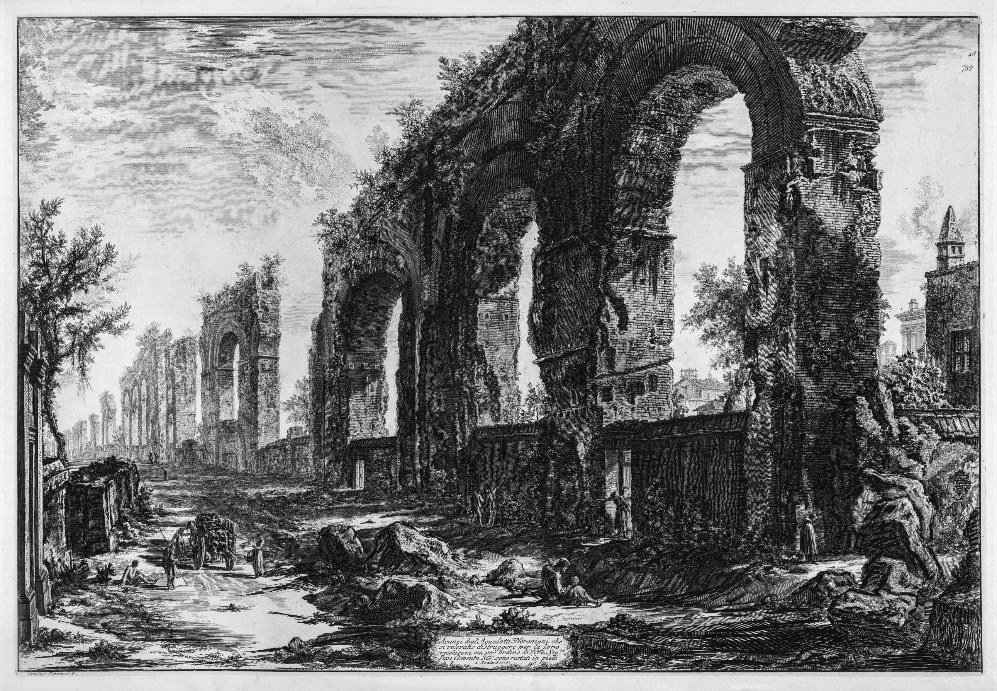
Nature is inexorable; as things fall apart, new forms of life emerge from their remains. Civita di Bagnoregio poignantly embodies this truth. The town’s near-Edenic appearance—vines cascading down cliffs, floral gardens spilling into stone alleys—portrays erosion not as destruction but as the slow but persistent creep of natural reclamation. The ability of nature to rework human construction is vividly captured in Giovanni Battista Piranesi’s eighteenth-century etchings of Roman ruins. In these images, humanity stands as a spectator witnessing nature consume ancient Rome’s marvels. Vegetation overtakes broken columns; cracks widen under the weight of time. Piranesi’s framing of ruins symbolically halt their dissolution, transforming the ongoing process of ruination into an object of aesthetic contemplation. His renderings exist somewhere between nature and culture, less concerned with historical accuracy than with evoking an emotional and intellectual response. In doing so, Piranesi demonstrates the life-giving power of the artistic medium to sustain memory and preserve the past. While Piranesi’s etchings are bound to the tactility of copper plate and ink, their power lies not only in what they depict but how they reframe ruination as an artistic and historical subject. In contrast to Piranesi’s etchings, digital scanning lacks a tactile presence—pixels instead of etched grooves—but offers something else: scale, access, and interactivity. Where Piranesi immortalized ruins through a singular artistic vision, digital reconstructions invite multiplicity. They are not artifacts alone, but platforms open to reinterpretation and collective exploration. Digital scanning captures Civita in flux, documenting erosion, overgrowth, and even the marks of tourism and time.
Consider, for instance, the origin of “ruin.” The term comes from the Latin ruere, meaning “to fall,” long associated with crumbled stones and collapse. When we frame an object as a ruin, we reclaim it from descent into decay, inviting cultural attention and care that, paradoxically, elevates its value. With this framing the past is preserved—not only through material restoration but the deliberate gaze which resists forgetting. Always teetering on the edge of erasure, ruins demand our care; yet if we intervene too much, their status as a ruin dissolves. Ruins persist not entirely whole, but not entirely gone.
Digitally reconstructing Civita di Bagnoregio provides an opportunity to both confront and embrace its inevitable transformation while recognizing that preservation is fundamentally intertwined with change. In translating the town’s fragile physicality into pixels and data points, we ensure that its stories, histories, and textures remain accessible, engaging, and vital for future generations. It reminds us that to preserve is not to fix something in time, but to attend to its unfolding. As sites of architectural and ecological significance increasingly face the threat of climate change, violence, overtourism, and neglect, digital reconstructions offer an alternative: light-touch visitation. These technologies replicate the experience of being there while sparing fragile sites the wear of constant foot traffic. They invite global engagement without erosion—access without impact.
This hybrid approach underscores the essential dialogue between digital technology and physical materiality, offering a resilient strategy for safeguarding cultural memory in the Anthropocene. Given the scale of these threats and humanity’s consumptive and extractive tendencies, prioritizing the digital recording of our built and natural heritage becomes not just a tool for preservation but an ethical imperative. It is how we ensure that future generations may still experience, learn from, and care for what we risk losing today.
During my stay in Civita, and in my reflections since returning to Seattle, I keep returning to the Etruscan concept of saeculum. This term refers to the span of time defined by a human life—within which memories persist through those who experienced events firsthand, maintaining their relevance and direct connection to the present. A local guide named Cinzia shared stories of her grandfather, born in Civita in the early 1900s. His daily rhythms—journeys into the valley to gather water, rear livestock, and harvest olives—mimicked those of his ancestors a century earlier, capturing a timeless pastoral Lazio now largely vanished. Yet even for Cinzia, those scenes feel impossibly distant. With her grandfather's passing, the clarity and solidity of these memories have faded, juxtaposed sharply against Civita’s transformation into a global attraction he could never have imagined. This raises an essential question for our time: Do we have a cultural and archaeological responsibility to keep material memories alive and accessible, now that we have the technological means to do so?
In our saeculum, where physical matter can be translated into virtual space as millions of data points, the human lifespan no longer constrains our collective memory. Instead, it is extended by the longevity and fidelity of our data. Civita di Bagnoregio provides a quiet counterpoint to the rapid transformations unfolding beyond its edges; even as it gradually recedes, it stoically persists. In the interplay of stone and pixel, ruin and renewal, Civita endures—its virtual counterpart standing resolute, freed from the erosive forces of nature and time.


%20Painting%20Outside%202.jpg)